- +353 1 685 5177
- info@thedroneguys.ie
Drone Surveying
We offer a wide range of drone survey services using our state of the art Unmanned Aircraft Systems which are more affordable, vastly quicker and pose fewer health and safety risks. We specialise in construction and land surveys for property development and GIS mapping for Agriculture.
Pre-Planning
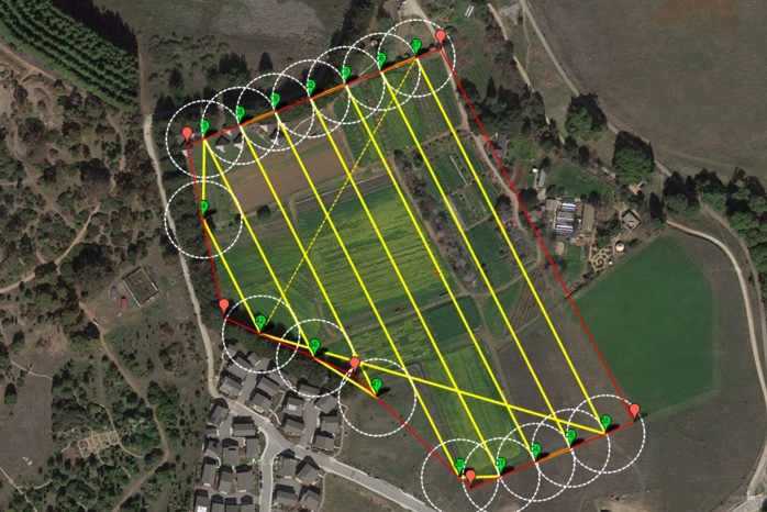
All our drones are equipped with digital camera, GPS and altitude sensor to fly pre planned flight lines and provide
overlapping aerial photography of the site.
Photo centre positions can then be accurately calculated using specialist software. The software is used to carry
out aerial triangulation and bundle adjustment of overlapping photos using GPS Camera positions, camera calibration
and ground control as reference. After this process has been carried out accurate 3D measurement can be obtained
digitally from the photo model.
This method can provide accuracies of up to +/- 20mm on hard detail features and an accuracy of up to +/- 50mm
on soft detail such as short grass. Accuracy of final deliverables is dependent on flying height, photo quality
and ground control configuration.
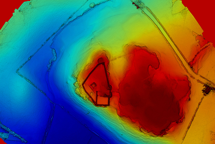
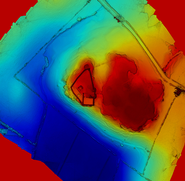
Orthomasaics Surveys, Terrain Models
and NDVI Analysis
All our surveys can produce various different types of outputs for various different needs. If you are looking
for an Ortho survey to show land levels and heights across the entire area including trees, buildings etc we can
produce these in a fraction of time it takes for traditional surveys.
Terrain Model are also easily produced to show Accurate topographic modeling, with DSMs.

Drone Surveys - Quicker, Cheaper and Safer
Drone Surveys take a fraction of the time compared to a traditional land surveys, we can cover 100’s of acres per
day from the safety of the one location, no need to climb scaffolding, over buildings or waste time walking long
distances over land.
Using our specialist software we can process all the data and have your results within 24 hours.